Map 28 – Sydenham – temporary closure – LIFTED
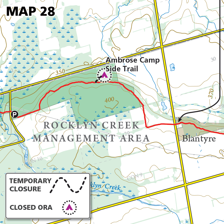
Map 28 – Sydenham – temporary closure – LIFTED Date Effective: Sept. 17, 2024 | Map 28, Edition 31 CLOSURE LIFTED Sept. 17, 2024 _______________________________ Original post: Sept. 25, 2023: The Ambrose Camp Side Trail along with the overnight rest…