Trail Changes and Notices

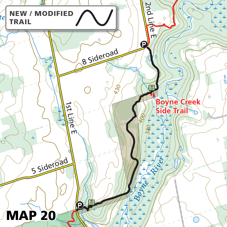
Map 20 – Dufferin Hi-Land – Boyne River, reroute

Map 20 – Dufferin Hi-Land – Boyne River, reroute Date Effective: Oct. 1, 2026 | Map 20, Edition 31 This section of Main Trail along the Boyne River has been rerouted following this temporary reconfiguration, and the Mulmur Lookout Side…

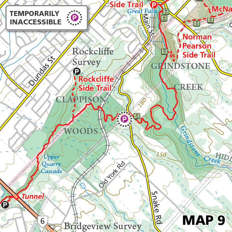
Map 9 – Iroquoia – Snake Road, parking inaccessible

Map 9 – Iroquoia – Snake Road, parking inaccessible Date Effective: Oct. 1, 2026 | Map 9, Edition 31 Due to construction on Snake Road, this parking area is temporarily inaccessible. The duration of the closure is expected to extend…

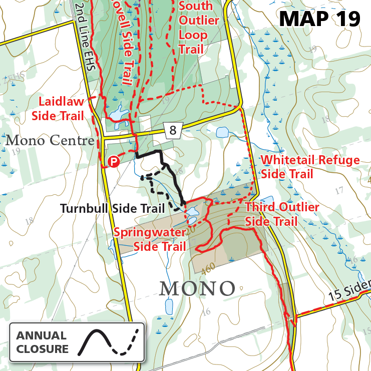
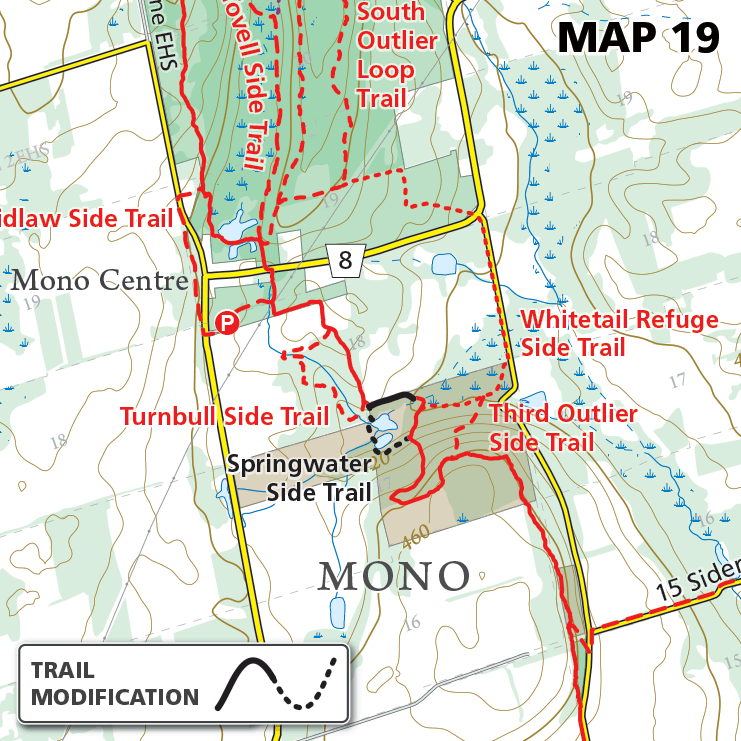
Map 19 – Caledon Hills – Whitetail Refuge, reroute

Map 19 – Caledon Hills – Whitetail Refuge, reroute Date Effective: Sept. 21, 2026 | Map 19, Edition 31 At BTC’s Whitetail Refuge Nature Reserve, a segment of the main Bruce Trail has been permanently rerouted and the Springwater Side…

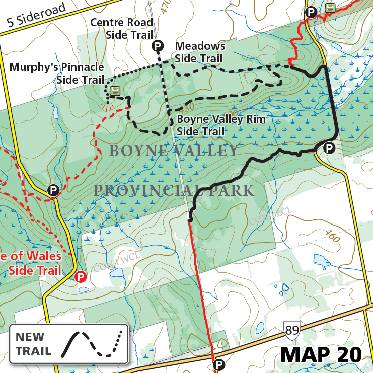
Map 20 – Dufferin Hi-land – Boyne Valley, permanent closure

Map 20 – Dufferin Hi-land – Boyne Valley, permanent closure Date Effective: Sept. 8, 2026 | Map 20, Edition 31 Update: Sept. 25, 2026 This closure has progressed to a Main Trail reroute and general reconfiguration outlined here. —————————————————————- Original…

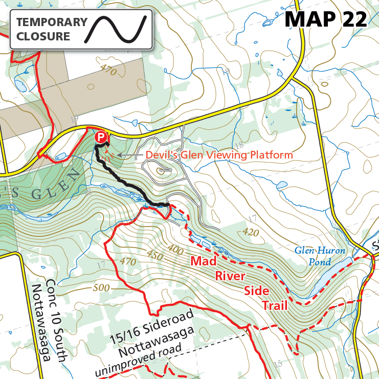
Map 22 – Blue Mountains – Devil’s Glen, fall closure

Map 22 – Blue Mountains – Devil’s Glen, fall closure Date Effective: Sept. 19, 2026 | Map 22, Edition 31 A portion of the main Bruce Trail within Devil’s Glen Country Club is scheduled to be temporarily closed from September…

Please Consider Making a Donation

$
One-Time Gift