Bruce Trail Sections and Maps
You can explore hundreds of kilometres of Niagara Escarpment beauty along the Bruce Trail.
Bruce Trail Clubs
The Bruce Trail Conservancy includes nine member Clubs, each corresponding to a section of the Bruce Trail. Each Bruce Trail Club is entirely volunteer run, and is responsible for maintaining, building and rerouting Trail, caring for the land, working with local landowners, organizing hikes and work parties, and promoting the Bruce Trail and the Bruce Trail Conservancy’s conservation work.
Downloadable Bruce Trail Maps
The 42 maps are identical to the print version of The Bruce Trail Reference – Edition 31, and are sent by email for use on a desktop. Trail changes since this edition are NOT incorporated in downloadable maps. Check our online Trail Changes & Notices for updates.
The Bruce Trail App
Plan and track your hikes along Canada’s oldest and longest marked footpath, and explore new areas along the Niagara Escarpment, with the most up-to-date route information, in an easy-to-use format. The Bruce Trail App can help beginner hikers, seasoned explorers, and aspiring End-to-Enders alike!
Features include:
Parking and camping information, connection to the GPS on your phone for directions, the latest trail changes and notices, measuring and planning tools, a tracking tool and more!
The new Bruce Trail App is available for iOS and Android devices by subscription.
Download the Bruce Trail App on the App Store or Google Play with a FREE 7-day trial. Then, to continue with unlimited access to the app and its ongoing trail updates, you can subscribe for $2.99/month or $29.99/year.
Proceeds from app subscriptions go to the Bruce Trail Conservancy to help maintain the app, care for the Trail, and support our conservation work.
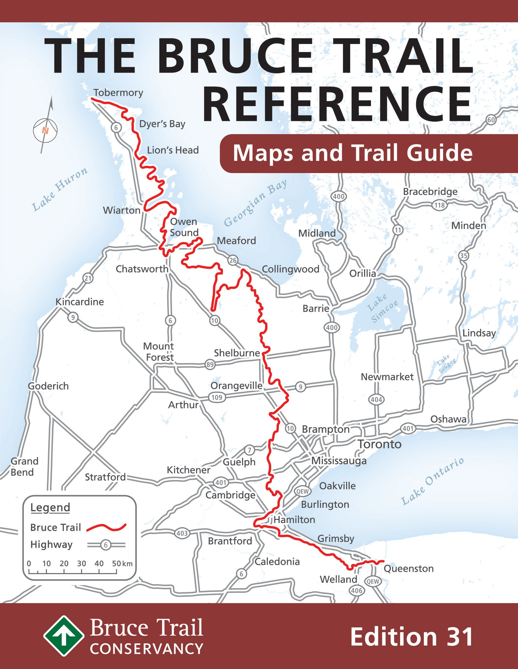
Bruce Trail Reference Guide
Taking the necessary time to look at a map before heading out on the Bruce Trail can help you plan for your adventure.
The Ultimate Resource for the Bruce Trail
The Bruce Trail Reference is updated every few years. The latest edition is Edition 31, published August 2023.
Edition 31 Features:
- 42 topographic maps of the Bruce Trail from Queenston to Tobermory (including parking, access points, and camping locations).
- Trail descriptions, kilometre-by-kilometre, for the main Bruce Trail and Side Trails
- Index Map of the entire Bruce Trail
- Introductory sections on the Bruce Trail Conservancy, Niagara Escarpment geology, flora and fauna, Indigenous Culture, Trail Safety, Map Information, and more.
- Field Guide to Niagara Escarpment Species (laminated fold-out; produced in collaboration with Waterford Press)
- NEW: Sections on Escarpment biodiversity, End-to-End hiking, and Dogs on the Trail.
- All in a 6-ring binder, with a removable vinyl sleeve for carrying individual maps
Order Edition 31 today >
Our insert-only version has all the same great content as The Bruce Trail Reference but does NOT include the binder or vinyl sleeve. Best for those with a binder from a previous edition or who don’t mind an unbound version.

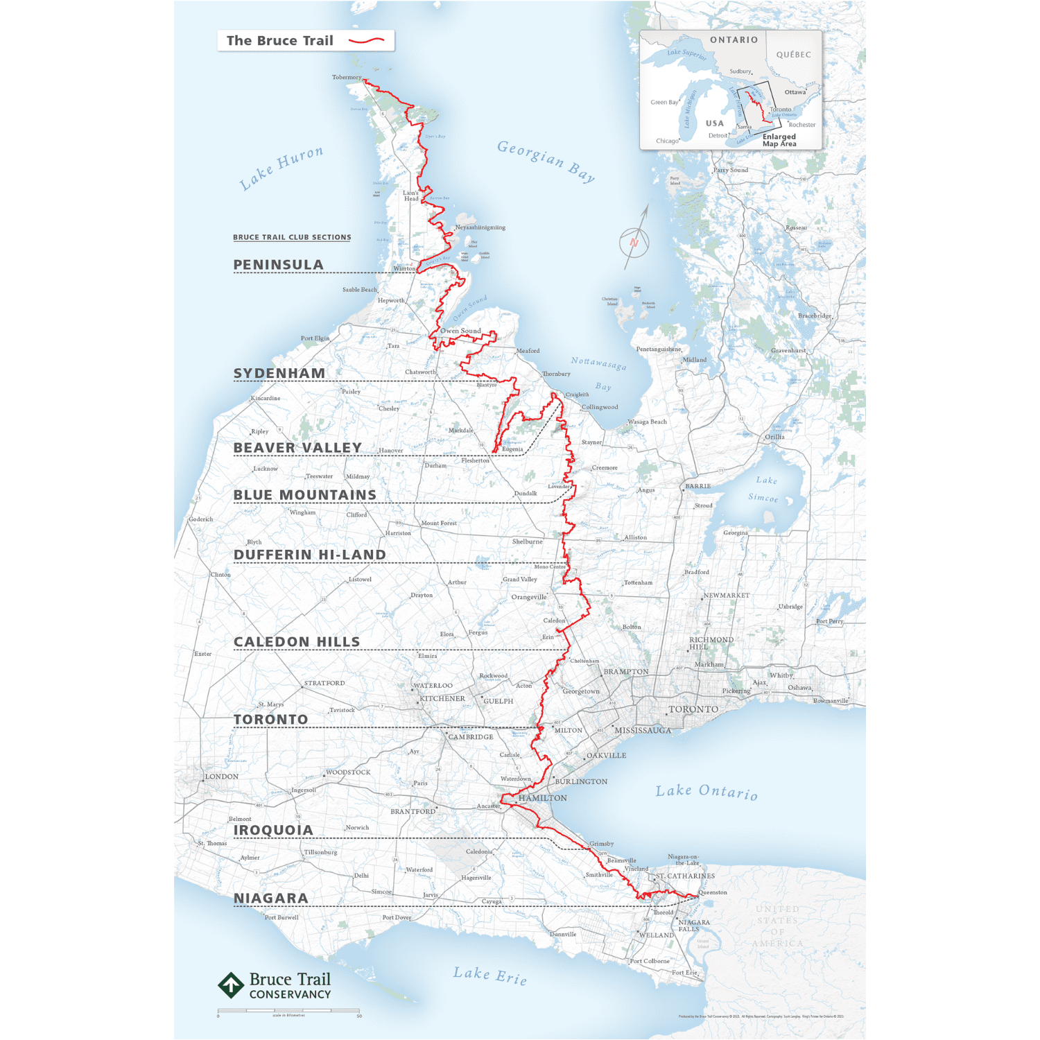
Bruce Trail Poster Map
Keep track of your Bruce Trail journey, or post it for inspiration.
Poster Size: 23.94″ x 35.94″
For general reference only. Not for hiking.
This map is not intended to replace the more comprehensive and accurate Bruce Trail printed hiking maps, available via the Bruce Trail Reference Guide or the Bruce Trail App.
Bruce Trail Updates: Changes and Notices
Re-routes, temporary closures, parking changes and other notices happen regularly along the Bruce Trail. Before heading out, always check for the latest trail changes or notices. The most recent trail changes and notices are below.
SEARCH HINTS:
- Enter a descriptive word, location, map number or trail section in the search bar below.
- To search by map number, include quotation marks. For example, “Map 34“.
- To search by map number with a single digits, include a space within the quotation marks, after the number. For example, “Map 3 “.
Trail Changes and Notices Search
Trail changes and notices can also be found in:
- Bruce Trail Conservancy Magazine: The maps printed in the magazine are printed at the same scale as the Bruce Trail Reference for easy cutting & pasting.
- Bruce Trail App: Trail changes are incorporated in real-time in the app. Remember to open your app when you have access to internet/wifi and it will download the latest available trail data.
Remember: If your map doesn’t match what you see on the trail, always follow the Bruce Trail blazes and heed any closure signage.
The Great Niagara Escarpment Indigenous Cultural Map
Along the Bruce Trail there exist a growing number of fascinating destinations that convey Indigenous culture and history.
These and other points of interest related to Indigenous peoples are also found in The Great Niagara Escarpment Indigenous Cultural Map. Developed by Plenty Canada, the map is a multimedia online resource containing stunning photography, captivating video, and contextual information that identifies important Indigenous historic, cultural, and natural world locations along the Niagara Escarpment. As The Great Niagara Escarpment Indigenous Cultural Map grows, the Bruce Trail Conservancy is committed to honouring Indigenous voices, and integrating Indigenous land-based knowledge and experience, heritage sites, and areas that are important to the protection of biodiversity into the maps and materials of the Bruce Trail Conservancy.
The Bruce Trail Conservancy and Plenty Canada worked together to integrate Indigenous content into this edition of the Bruce Trail Reference. These points of interest include:
1) Landscape of Nations: The Six Nations & Native Allies Commemorative Memorial, which honours Indigenous contributions made during the War of 1812 [Map 1];
2) the First Nations Peace Monument, which recognizes the fateful meeting between Laura Secord and First Nations allies [Map 3];
3) the Souharissen Natural Area, named after the hereditary leader of the Chonnonton Nation [Map 9];
4) the Crawford Lake Iroquoian Village, that reveals reconstructed longhouses [Map 11];
5) the Wiidosendiwag (Walking Together) Trail, that presents Saugeen Ojibway symbolic sculptures [Map 33]; and
6) Neyaashiinigmiing (Point Of Land Surrounded On Three Sides By Water), home to the Chippewas of Nawash Unceded First Nation [Map 36].

Cultural mapping is emerging as an exciting interdisciplinary field that is fully compliant with and supported by the multi-media capabilities of the Internet. As such, the interactive map of The Great Niagara Escarpment is layered upon the land featuring appropriate knowledge and histories of meaningful Indigenous locations to re-establish Indigenous experience and voice upon this ancient and special geologic formation. Within the context of the Niagara Escarpment, Plenty Canada worked with Indigenous advisors and a growing network of professional allies to document, celebrate, and safeguard important Indigenous heritage resources.
Tim Johnson, Senior Advisor

Join us for a hike!
The Bruce Trail Conservancy hike program is open to Bruce Trail Conservancy members and non-members.


