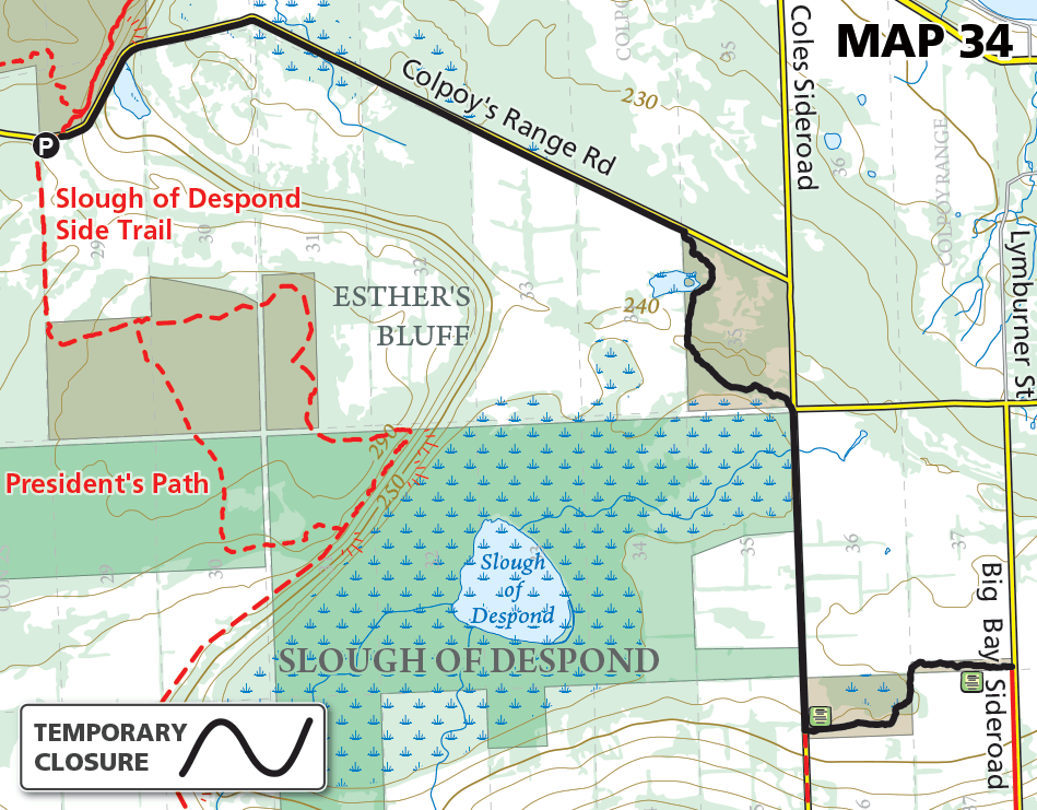
Map 34 – Sydenham – Slough of Despond area, temporary closure due to flooding – LIFTED
Date Effective: Apr. 14, 2026 | Map 34, Edition 31
UPDATE Apr. 29, 2026
Conditions have improved and the Bruce Trail has re-opened from Big Bay Sideroad to the roadside parking on Colpoy’s Range Road the north end of the Slough of Despond Side Trail.
_______________________________
UPDATE Apr. 23, 2026
The Bruce Trail in this area remains closed, and Coles Road remains closed to traffic due to flooding.
_______________________________
ORIGINAL POST Apr. 14, 2026
The main Bruce Trail in the Slough of Despond area is temporarily closed due to flooding until further notice. The closed portion is from Big Bay Sideroad to the roadside parking on Colpoy’s Range Road the north end of the Slough of Despond Side Trail.
This is one of four areas in the Sydenham section of the Bruce Trail temporarily closed due to flooding from heavy rains:
1. Bognor Marsh & Silent Valley (km 27.0 – 34.5)
2. Lesich property (km 71.1 – 72.2)
3. Boyd property (km 81.3 – 83.9)
4. Slough of Despond (km 149.1 – 155.2) – this notice
(Kilometre references correspond to the Bruce Trail Reference, Maps and Trail Guide, Edition 31. See links above for individual maps of these closures.)