Maps 29/30/31 – Sydenham – Bognar Marsh, temporary closure due to flooding – LIFTED
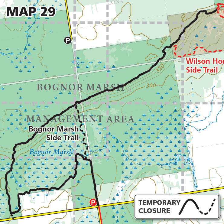
Maps 29/30/31 – Sydenham – Bognar Marsh, temporary closure due to flooding – LIFTED Date Effective: Apr. 14, 2026 | Map 29, 30, 31, Edition 31 UPDATE May. 6, 2026 The main Bruce Trail within Bognar Marsh and Silent Valley…