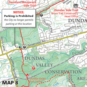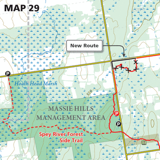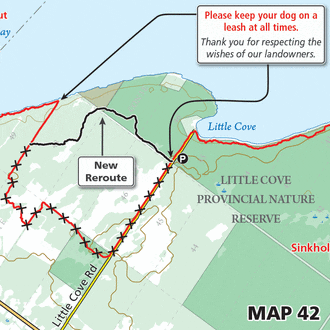
Map 26 – Beaver Valley – Parking prohibited

Map 26 – Beaver Valley – Parking prohibited Oct. 30, 2020 | Map 26, Edition 30 The landowner no longer allows parking at this location. Please respect the landowners wishes.

Map 26 – Beaver Valley – Parking prohibited Oct. 30, 2020 | Map 26, Edition 30 The landowner no longer allows parking at this location. Please respect the landowners wishes.

Map 8 – Iroquoia – Reroute, Canterbury Falls Oct. 28, 2020 | Map 8, Edition 30 The generosity of a landowner granting permission to have the Bruce Trail on their land has allowed for a new trail configuration to appear.…

Map 37 – Peninsula – Rush Cove Road Side Trail Oct. 27, 2020 | Map 37, Edition 30 A new side trail has been created to formally lead hikers from the municipal parking area on Rush Cove Road to the…

Map 13 – Toronto – Reroute, Hwy 7 Oct. 5, 2020 | Map 13, Edition 30 710 metres of the Bruce Trail has been moved off of the gravel shoulder of Highway 7 further away from the highway within the…

Map 26 – Beaver Valley – Reroute, Stew Hilts Side Trail Oct. 5, 2020 | Map 26, Edition 30 Phase II of the Stew Hilts Side Trail has taken place connecting the southernmost end of the side trail to the…

Map 26 – Beaver Valley – Reroute, East Mountain Oct. 5, 2020 | Map 26, Edition 30 An impressive 2 km reroute has taken place on BTC preserved land thereby eliminating 1.7 km of road walking. Decommissioned trail = 1.7…

Map 23 – Blue Mountains – Reroute, Pretty River Jul. 31, 2020 | Map 23, Edition 30 A portion of the main Bruce Trail has been rerouted within Pretty River Valley Provincial Park. Decommissioned trail = 220 metres New main…

Map 26 – Beaver Valley – Reroute, Eugenia Falls Jul. 31, 2020 | Map 26, Edition 30 The Bruce Trail has been rerouted within the north end of Eugenia Falls Conservation Area. Decommissioned trail = 170 metres New main Trail…

Map 38 – Peninsula – Moore Street Side Trail Jul. 31, 2020 | Map 38, Edition 30 By request of the landowner the Moore Street Side Trail has been closed. Please respect the landowners wishes. Trail Closure = 1.5 km

Map 29 – Sydenham – Temporary Closure & Walter’s Falls Side Trail Jul. 25, 2020 | Map 29, Edition 30 The section denoted above from Townline Rd north is temporarily closed until further notice. A temporary thoroughfare has been established…