Map 26 – Beaver Valley – Eagle’s Summit Trail Network
Date Effective: Sept. 8, 2025 | Map 26, Edition 31
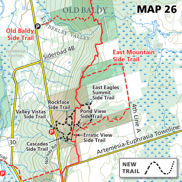
Following the BTC’s securement of Eagle’s Summit Nature Reserve (earlier this year) and a major reroute of the main Bruce Trail on the property, a new network of seven scenic side trails has been created.
The new side trails, together with the Main Trail, offer a multitude of loop hike options ranging in length from less than 0.4 kilometres to more than 4 kilometres, and provide hikers with responsible access to forests, meadows, rock faces, gorges, ponds, and spectacular views.
This wonderful new network is make possible through the work of the Beaver Valley Bruce Trail Club together with local landowners and the Grey Sauble Conservation Authority.
Cascades Side Trail (560 metres)
Valley Vistas Side Trail (710 metres)
Rockface Side Trail (510 metres)
East Eagle’s Summit Side Trail (480 metres)
Pond View Side Trail (170 metres)
Erratic View Side Trail (70 metres)
East Mountain Side Trail (3.2 km)