
Map 20 – Dufferin Hi-Land – Boyne Valley, reroute and reconfiguration
Date Effective: Sept. 25, 2026 | Map 20, Edition 31
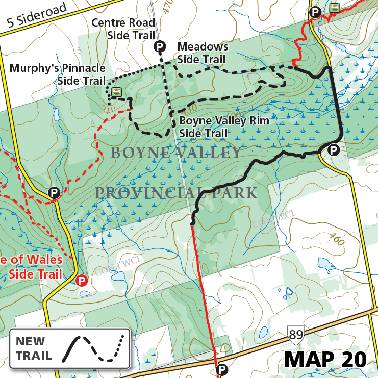
Due to ongoing seasonal flooding, a damaged bridge has been removed and a low-lying section of trail has been permanently rerouted, along with a reconfiguration of the side trail network within Boyne Valley Provincial Park.
New Main Trail = 2.6 km
Meadows Side Trail = 1.2 km
Centre Road Side Trail = 450 metres
Murphy’s Pinnacle Side Trail = 660 metres
Boyne Valley Rim Side Trail = 2.5 km