
The BTC office will be closed on Mon. Oct. 12 for the holiday. Thank you for your understanding.
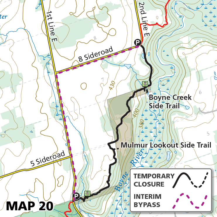
Map 20 – Dufferin Hi-Land – Boyne River, temporary bypass – LIFTED
Date Effective: Sept. 18, 2026 | Map 20, Edition 31
UPDATE: Oct. 1, 2026
This temporary bypass has been lifted and a new permanent Main Trail reroute is in place.
————————————————————————
ORIGINAL POST: Sept. 18, 2026
A segment of the main Bruce Trail along the Boyne River, along with the Boyne Creek Side Trail and Mulmur Lookout Side Trail, is temporarily closed while work is completed to establish a new route on BTC land. Until that time, a temporary bypass is in place to follow 1st Line East and 8 Sideroad.
Temporary Bypass: 3.2km