
Map 13 – Toronto – Silver Creek, reconfiguration and new parking
Date Effective: Jul. 19, 2026 | Map 13, Edition 31
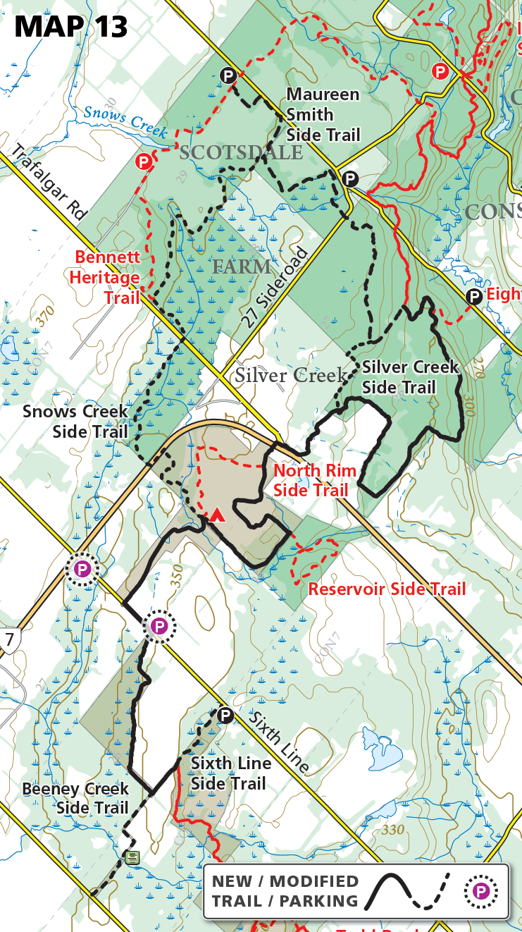
Following the acquisition of two new protected natural areas in the Silver Creek area, a major trail reconfiguration has taken place and two new recommended parking locations have been confirmed.
This reconfiguration has routed the Main Trail on a more natural route, removing 1.2 km of trail from Sixth Line and a further 720 metres from a stretch paralleling Highway 7.
Trail Distances
New Main Trail = 7.8 km
Sixth Line Side Trail = 480 metres
Beeney Creek Side Trail = 820 metres
Snows Creek Side Trail = 3.6 km
Silver Creek Side Trail = 620 metres
Maureen Smith Side Trail = 2.9 km
New Roadside Parking
Sixth Line south – parking on the east side of Sixth Line, opposite the point where the main Trail meets the road.
5 car capacity
N 43.662205°, W 79.990407°
Sixth Line north – parking on the west side of Sixth Line, immediately south of Highway 7.
3 car capacity
N 43.666155°, W 79.995902°
To be legally parked, all cars must be completely off the pavement and on the shoulder of the road.