Map 19 – Caledon Hills – Whitetail Refuge, temporary reroute
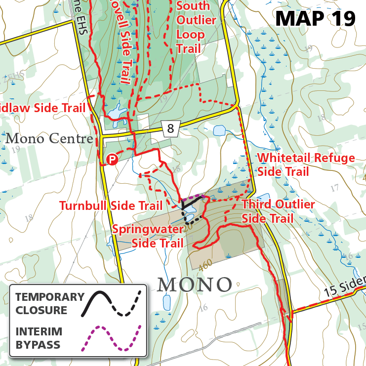
Map 19 – Caledon Hills – Whitetail Refuge, temporary reroute Date Effective: Jul. 24, 2026 | Map 19, Edition 31 A segment of the main Bruce Trail is temporarily rerouted and the Springwater Side Trail is temporarily closed at Whitetail…